Boise sits at 2,730 feet above sea level in the Treasure Valley, where the Boise River has deposited a complex mix of alluvial sands, silts, and gravels over millennia. For any project here—from the expanding downtown core to the Bench neighborhoods—understanding the full particle size distribution is non-negotiable. We perform grain size analysis using the combined sieve and hydrometer method to capture everything from coarse gravel down to clay-sized particles smaller than 0.002 mm. This data feeds directly into soil classification per ASTM D2487 and informs decisions on compaction, drainage, and slope stability. Before designing foundations, we often recommend pairing this with a site-specific SPT campaign to correlate blow counts with gradation curves.
A single grain size test can shift a compaction specification from standard to modified Proctor, saving months of rework on site.
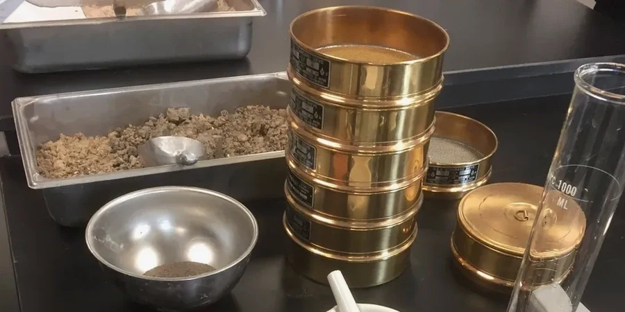
Method and coverage
Regional considerations
The biggest risk we see in Boise construction is assuming uniform gradation across a site. The alluvial deposits along the river change from clean sands to high-plasticity silts within 50 meters. Build a foundation on sand classified as SW while the neighbor's lot has ML material, and differential settlement is almost certain. Our grain size analysis catches these transitions early. We map the fines content across the parcel and flag any layer where the percent passing No. 200 exceeds 35%—that triggers a need for liquefaction screening in the seismic zone 2B per IBC 2018.
Standards that apply
ASTM D422-63 (Standard Test Method for Particle-Size Analysis of Soils), ASTM D6913-17 (Standard Test Methods for Particle-Size Distribution of Soils Using Sieve Analysis), ASTM D2487-17 (Standard Practice for Classification of Soils for Engineering Purposes), AASHTO T-88 (Particle Size Analysis of Soils)
Related services
Combined Sieve & Hydrometer
Full gradation curve from 75 mm down to 0.001 mm using mechanical sieves and the ASTM D422 hydrometer method.
Wet Sieve Only (Fines < 10%)
For clean sands and gravels where fines content is low. Quick turnaround for base course and filter material verification.
Dry Sieve Only (Coarse Soils)
For aggregates, crushed rock, and granular fills. Meets ASTM D6913 for material acceptance on roadway projects.
Percent Fines Determination
Rapid wash test (No. 200 sieve) to assess silt/clay content. Critical for compaction control and drainage layer specification.
This service complements our laboratory testing work for a complete project analysis.
Typical parameters
Top questions
What is the difference between sieve analysis and hydrometer analysis?
Sieve analysis separates particles down to 0.075 mm (No. 200 sieve) using stacked mesh screens. Hydrometer analysis measures particles between 0.075 mm and 0.001 mm by tracking sedimentation rate in a water column. For complete gradation—especially when fines content exceeds 10%—both methods are combined.
How much does a grain size analysis cost in Boise?
A combined sieve and hydrometer test typically ranges from US$90 to US$170 depending on sample preparation, number of sieves, and whether a full hydrometer curve is required. Volume discounts apply for multi-sample projects.
Why do I need a hydrometer test for my Boise project?
Boise's alluvial soils along the river contain significant silt and clay fractions that pass the No. 200 sieve. Without hydrometer data you cannot distinguish between silt (ML) and clay (CL/CH), which affects plasticity, compaction curves, and frost susceptibility. The hydrometer reveals the true clay fraction.
How long does the test take and when do I get results?
The sieve portion is completed in one day. The hydrometer sedimentation requires 24 hours of readings. Total turnaround is 3 to 4 business days from sample delivery. We provide the full gradation curve, D10/D30/D60 values, and USCS classification.