ASCE 7-22 requires site-specific seismic amplification analysis for any structure in Seismic Design Category D or higher. In Boise Idaho, the Treasure Valley basin creates a deep sediment column that amplifies long-period ground motions far beyond what the default code values predict. Our team uses the MASW method to measure shear-wave velocity (VS30) directly at your site. That data feeds into the NEHRP site classification system, producing a factual Site Class — not a guess based on generic geology. We also cross-reference with existing borehole logs and microtremor HVSR surveys to confirm the basin-edge effects that are common along the Boise Front.
The Treasure Valley basin can amplify long-period ground motions by a factor of 2.5 or more relative to bedrock sites — a fact often missed by generic code values.
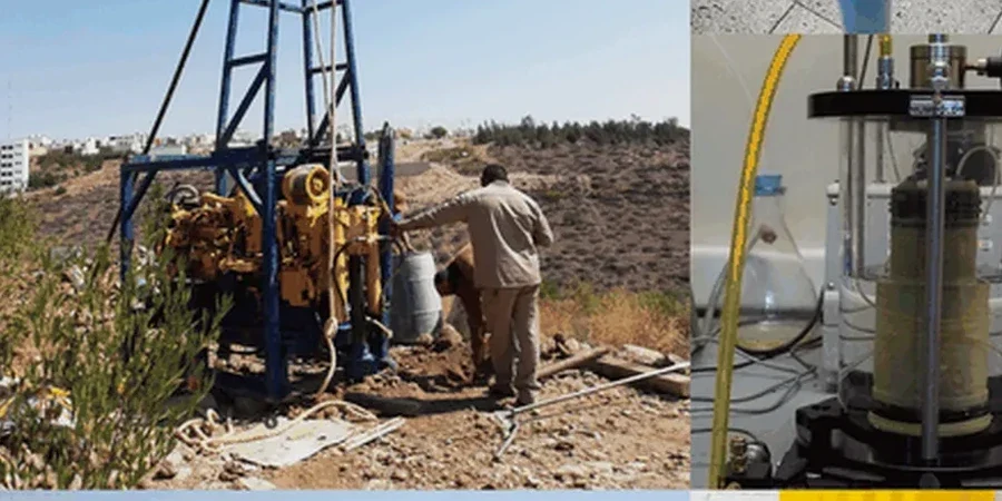
Method and coverage
Regional considerations
The difference between a site on the Boise Bench and one near the Greenbelt is dramatic. Bench sites often sit on basalt or dense gravels — Site Class B or C — with low amplification. But in the river corridor, you find 30-plus meters of soft alluvial silts and sands that classify as Site Class D or E. During the 2020 Stanley earthquake (M 6.5), residents in the valley felt shaking for nearly a minute while those on the bench felt only a brief jolt. That is the basin amplification effect. Ignoring it means designing for ground motions that could be 50 percent lower than the actual demand. Our analysis quantifies that difference site by site, so your structural engineer gets real numbers.
Standards that apply
ASCE 7-22 (Chapter 20 – Site Classification Procedure), ASTM D4428/D4428M (Surface Wave Testing), IBC 2021 (Section 1613 – Seismic Ground Motion Values)
Related services
MASW / VS30 Survey
Non-invasive array testing with 24 geophones. Delivers VS30, NEHRP site class, and a 1-D shear-wave velocity profile. Ideal for single-family homes to large subdivisions.
HVSR (Microtremor) Measurement
Records ambient vibrations for 30 minutes per station. Identifies the fundamental resonant frequency of the soil column — critical for matching building period to avoid resonance.
2D Shear-Wave Profiling
Multiple MASW lines along a transect produce a 2D cross-section of VS variation. Useful for mapping buried channels or lateral changes in soil stiffness across a parcel.
Seismic Hazard Deaggregation Review
We take the USGS hazard data for your Boise Idaho location and deaggregate it to identify the controlling earthquake scenario (magnitude + distance). This feeds directly into site-response analysis.
Typical parameters
Top questions
How much does a seismic amplification analysis cost in Boise Idaho?
A standard MASW survey with VS30 calculation and NEHRP site class report costs between US$1,010 and US$1,970. The final price depends on array length, number of profiles, and site access conditions.
Do I need a site-specific seismic amplification study for a single-family home in Boise?
The 2021 IBC requires site-specific analysis when the mapped spectral response at 1-second period exceeds 0.6 g. Many parcels in the Treasure Valley fall into that range. If your structural engineer specifies Site Class D or E, a VS30 measurement is the only way to confirm the actual class and avoid over-design or under-design.
What is the difference between VS30 from MASW and VS30 from an SPT correlation?
MASW measures actual shear-wave velocity through the soil profile. SPT-based correlations estimate VS30 from blow counts using empirical formulas that were developed for specific soil types — they can be off by 20 to 30 percent in the mixed alluvial soils of the Boise Valley. Direct measurement is always more reliable for design.
How long does the field work take for a typical lot in Boise?
A single MASW line takes about 2 hours including setup, data collection, and breakdown. For a standard residential lot we usually run one line. For commercial sites we recommend two orthogonal lines, which takes half a day.
Can you perform the test during winter in Boise?
Yes. The MASW equipment operates in temperatures down to -10°C. Snow cover does not affect the results as long as the geophones are planted in unfrozen soil or through the snow into the ground. Frozen ground can change the near-surface velocity, so we avoid testing when the top 15 cm are frozen.